Interested ? Lets plan your trip !
Rupi Bhaba Wildlife Sanctuary Trek
04 Nights 05 Days, Himachal Pradesh, India
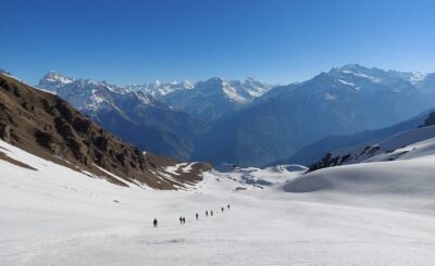
The Rupi-Bhaba Sanctuary on the right bank of the Sutlej occupies the greenest corner of Kinnaur. Backed by the Srikhand Range, its valleys allow free access to the monsoon travelling up the Sutlej. Rupi-Bhaba also has the greatest altitudinal range among Kinnaur’s three sanctuaries (1,200-6,000m). This enables you to see vegetation ranging from the sub-tropical to the alpine, and a wide range in fauna, all in a day and a half’s march.
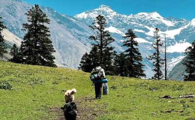
Down by the Sutlej, large-leafed, gnarled trees of melotus, and the smaller span of the ficus, exist in strange proximity with the chir pine. At one or two places there are even groves of banana trees. Warm, subtropical growth gives way to cooler mountain vegetation near the villages – oak, blue pine, temperate fruit trees (birdcherry, wild apricot, peach and pear) and, on occasion, the deodar. Further up, spruce and then fir predominate and finally, high altitude oak and birch take over as the limits of the treeline are approached. The pasture country beyond is rich and extensive, attracting flocks from great distances, especially the wide spaces of the upper Bhaba Valley.
Near the Sutlej, the goral, an antelope, is the herbivore most frequently sighted. Further up is the habitat of the ungainly serow, then the majestic tahr and dainty musk deer and finally, near the Spiti border is blue sheep and ibex country. The carnivores here are mostly from the feline family. Leopards are the largest of this clan and have for company the leopard cat and the lynx. In the lower areas, the black bear is greatly feared while in the upper reaches, the brown bear prowls the pastures with only an occasional straying snow leopard from Spiti to share his supremacy. Smaller carnivores include the marten and the fox. For bird life, the sanctuary’s major boast is the Western Himalayan horned tragopan. Other pheasants likely to be seen include the monal, the kalij, the koklash and, sometimes in the lower reaches, the chir. Also present, in the upper areas, is the snow cock.
With only a limited road network, the Rupi-Bhaba Sanctuary has to be explored on foot. For the real wildlife enthusiast, it is worth moving from village to village, keeping additional days for forays up the various side valleys. This route stays close to the Sutlej River but covers the catchment of every tributary, starting with the Rupi and moving eastwards through the Shorang and the Salaring and ending in the Wangar. You can trek anywhere between five and ten days, depending on the time available for making forays up the different valleys in the sanctuary.
Rupi Bhaba Sanctuary Highlights
Village Chaura (7 hrs from Shimla)
Village Chaura
Shimla Railway Station
Bhuntar airport near Mandi
To get to the starting point of Chaura, drive from Shimla to Rampur or Jeori, as they offer a greater choice in accommodation. Head to Chaura the following morning. Chaura also has a Forest Rest House and, if you like, you could try and get a room there, or camp on its grounds. This would allow you to make an early start the next morning.
Take the path from the motor road at Chaura (1,800m) down to a footbridge that spans the Sutlej. The 1,100 m climb on the Sutlej right bank is best tackled in the cool of early morning. Reaching the hamlets of Rupi (2,400m) under a mid-day sun can become a pitiless, sweat-stained ordeal.
Once across the footbridge, the trek moves upstream, along the right bank of the Sutlej, for about 1 km. Cross the Rupi stream near its confluence with the Sutlej, and climb the hillside on its left bank. A right bank path is shorter but this relentless climb, with no water en route, is best avoided. On the main bridle path, there are two springs. The first is near the bridge over the Rupi stream and the second in a boxwood grove halfway up the main climb (the water is sweet but not too clear). After almost 3 hrs of climbing, the pretty temple of Hurua, atop a little knoll, heral the arrival of Rupi Valley habitation.
The path now moves right (north) into the Rupi bowl on a gentle gradient. A little over a kilometre beyond temple, the Rupi stream is crossed. A steep climb on its right bank enables to reach Nalling and Majgaon hamlets. Rupi is about 1 km further north-east from Majgaon. It has a beautifully located Forest Rest House where one can camp overnight. If you have an extra day, you can visit the Bampa pasture located above the treeline, immediately behind the rest house. The steep climb will definitely be rewarded with monal sightings en route, besides the additional possibility of seeing tahr and bears.
From Rupi to Bara Kamba (2,100m), moving east to the Shorang Valley, there are two options an uphill, forest path that descends to cross the Shorang stream by a footbridge, and a newer path reaching the Shorang much lower downstream and crossing the stream by a jhula (a metal basket Slung from a steel rope). The latter path is a shorter and more direct route to Bara Kamba but the forest path is an infinitely superior option for the die-hard nature lover.
From the rest house, the path circles southwards out of the Rupi Valley, moving back towards the Sutlej on more or less even contours. Then ascending the pine and spruceclad ridge behind Dubling Village (visible below the path), it descends sharply on the farther (eastern) side to a bridge on the Shorang, below the hamlet of the same name.
The views up and down the Sutlej Valley are great all the way to the ridge top and, on the way down, there is a definite possibility of spotting bears feeding on wild fruit in the shaded gullies. Once across the bridge do not climb up to the Shorang houses. The more or less level path runs along the Shorang left bank, leaving the stream far below as it tumbles precipitously to reach the Sutlej River.
The last kilometre or so of the 5-km distance from the bridge ascends gradually through the fields of Bara Kamba, past the village, to a little rocky spur commanding great views of the Sutlej Valley. You can try the Irrigation and Public Health Department Rest House here or pitch tent.
TREKKING OPTIONS
For those with time to explore the Shorang Valley, it takes at least 2 days to walk to the base of the Kamba Khango Pass leading to the upper Bhaba Valley. Worth it for wildlife enthusiasts, who can catch a glimpse of the entire range of wildlife in the valley, from goral to ibex. For those with less time, part way up maybe almost as satisfying. A day’smarch until just beyond Dumti (2,705m), at the confluence of two major tributaries of the Shorang, will provide opportunities of sighting the serow, tragopan, bear, marten and leopard en route. Basic provisions can be obtained in all the villages but there is no habitation up valley beyond the Shorang hamlet – so all provisions and camping gear have to be carried beyond here. One cannot take loaded animals up the Shorang so it may be necessary to hire porters in Bara Kamba.
Camping is possible at Dumti and at many places in the pastures beyond along the eastern tributary of the Shorang that leads to the Kamba Khango Pass. The route is straight forward and a guide is not essential.
If one has taken time off to explore the innards of the Shorang Valley, there is a kind of ‘find your own path along shepherd trails’ alternative in moving on to the smaller valley of Salaring (1,800m). Climb the ridge behind the hamlet of Shorang traversing east across the pastures of the Kamba villages and descending to the Salaring stream.
If you haven’t done Shorang and are starting from Bara Kamba, the easier, more travelled route is along the village paths heading east, via the villages of Chhota Kamba (2,000m) and Gharsu (2,175m).
The other option to Salaring is to take an old forest inspection path, which stays just above these villages. Moving up the main Sutlej Valley, this forest path traverses east along steep hillsides, leaving the village of Chhota Kamba below. About 2 hrs out of Bara Kamba, the path climbs over a small spur to come up above the village of Gharsu, still in the main Sutlej Valley. It then circles left (north) away from the Sutlej and into the Salaring Valley.
Salaring is the most secluded of the three smaller valleys in the Rupi Bhaba Sanctuary. Invisible from the road, it’s tucked between the Shorang and the Bhaba valleys. About 40 mins from Gharsu, one comes to the hamlet of Rokcharang, above the right bank of the Salaring stream. From here, a path descends a short distance to a jhula crossing over the Salaring stream. Do not cross. A path moves north up the right bank of the Salaring, from the jhula, to a small forest inspection hut located about a kilometre away where one can stay or camp overnight. Less than an hour’s walk up the left bank, brings up the tiny hamlet of Salaring, located at a meeting point of two tributaries. With an extra day to explore Salaring Valley, one can move up the valley the next day. The valleys on either side offer the best chances of spotting musk deer.
Go back to the jhula over the Salaring and cross to the right bank. On the other side, the path ascends gradually south towards the main Sutlej Valley. Barely a kilometre away is Kachrang, with 12 households, the largest habitation in Salaring Valley. If you want to head back home from Kachrang, it is possible to go down south to a jhula over the Sutlej and climb up to National Highway 22 on the other side, just beyond Bhabanagar, 180 km from Shimla.
The path from Kachrang towards Sak Kanda (2,900m) climbs left (east) gradually coming out on bare, steep slopes, which tumble down to the Sutlej. Traversing these slopes east- wards up the Sutlej, it reaches Nathpa (2,055m). Nathpa is strung out in a long, narrow line. It stretches more than 300m along the bare slopes, ending close to a spruce forest.
Heading up to the top of Nathpa, the path cuts through the spruce trees to the single crop fields of Sak Kanda. Located on the shoulder of a spur sloping towards the Sutlej, Sak Kanda overlooks the catchment of the Kandar Nallah, This is the smallest of the independent valleys terminating on the Sutlej, in the Rupi-Bhaba Sanctuary.
There is no rest house at Sak Kanda but the fallow fields offer plentiful sites for camping out.
The forest path from Sak Kanda to Bhaba was earlier constructed to circle above Tholach Kanda and move north-east into the Bhaba Valley. But the erosion in one Pagal (lunatic) Nallah has made this route impossible now.
The walking track to the Bhaba climbs steeply from Sak Kanda itself crossing the 3,900m ridge top in a north-easterly direction through forest and pasture. The bowl of the Bhaba Valley is clearly visible from the top. The descent is steep and long. While many footpaths criss-cross the route through forest and pasture, one just needs to stick to the ones leading down (east).
They come out either directly at the Electricity Board Rest House at the Katgaon (2,200m), located on Wangar right bank, or in one of the two picturesque villages of Bai or Kafnu. The rest house is between the two villages, and within a couple of kilometres of easy walking from either of them.
Those not keen on the ridge crossing from Sak Kanda, have an easier option to reach the Bhaba Valley. Crossing over from Sak Kanda to Tholach Kanda, one can descend towards the Sutlej, on the ridge edging the left side of the Kandar Valley to reach a now abandoned rest house built by the electricity board. From here, an old project road descends south in a series of zigzags to join up with the 17-km Wangtu-Katgaon Link Road. This road offers the option of a lift or bus ride as it climbs north into the Bhaba Valley.
The Bhaba Valley is the most extensive in the Rupi Bhaba Sanctuary and is famous for the equally extensive pastures in its upper stretches. If time permits, do trek over the Pin-Bhaba Pass to Spiti, and the beautiful lush green meadows of Mulling, Kara and Tiya en route.
An alternative trek to get back into the Sutlej Valley is also available. A kilometre or so below the rest house at Katgaon, a bridge crosses over the Wangar stream to the left bank and a path traverses right along the hillside, past a couple of small hamlets to enter the valley of the Kangarang tributary of the Wangar. Moving east into the valley, the path circles up and around to the south at the head of the valley. A steep ascent from here brings up the Rusnang Pass (3,650m), crossing into the main Sutlej Valley high above the large village of Chagaon. Prepare for a 7 to 8 hr tiring walk on this stretch. From Chagaon, a motor road leads down to Tapri (7 km) on NH22, from where regular buses or taxis can take one to Shimla
FROM SHIMLA to Rampur, it’s 116 km/ 5 hrs by (Rs 1,550 to 1,950) or 6 hrs by (Rs 100). Plenty of buses leave from the Lakkad Bazaar Bus Stop (Tel: 0177-281 1259) through the day and night daily Rampur to Chaura is 34 km via Jeori (23 km). Take any Recongpeo bus, easily available, for Chaura (3 hrs/Rs 50). Rampur taxis charge approximately Rs 600 for the 21/2-hr drive to Chaura. Alternatively, negotiate with the Shimla taxi
RETURN Take a taxi (Rs 3,500/ 8 hrs) or a bus (Rs 185/ 10 hrs) from Katgaon (204 km). There are three buses during the day5.30 and 6.30 am and 1.30 pm via Wangtu, en route to Shimla
TIP: Rupi is the wettest valley of Kinnaur. Travel before or after the rains
Yes, it is absolutely essential to take a guide for this trek whether you are trekking solo or in a group.
The best season for Rupi Bhabha Wildlife Sanctuary is from October to March.
It is ideally recommended for 15+ age group.
Yes, in fact all the Himalayan trails are quite safe for women & solo travelers. People of the region are very warm, caring & hospitable in nature.
Camping tent accommodation (2-3 per tent).
Guides & porters in the region will never demand any tip money from you. They just need their daily wages paid by the trek operator. However, it is always encouraging if one can give a little tip to them if they provide good services.
Indian currency is accepted
Get best price offer, itinerary, details & instant booking link for this trek